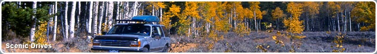
Scenic Drives in Pinedale, Wyoming
Page Summary: A guide to popular scenic drives in Wyoming. See mountains, peaks, wildlife, lakes, and rivers from your car.
 Scenic Drives
For those who want to enjoy a leisurely drive to see the beauty of Sublette County from their vehicles, there are many choices from paved road by-ways to winding, bumpy gravel and dirt roads. The trips listed below are suitable for passenger sedans, with the exception of the Union Pass trip. Many back road areas are best driven with a higher-clearance, 4-wheel drive vehicle. Be sure to start out with a full tank of gas and have a good spare tire along, just in case. As a general rule traveling in rural Wyoming, it's also a good idea to make sure your vehicle has emergency equipment such as a spare blanket, matches, snacks, water, a cell phone, and a map if you're not familiar with where you are going.
Popular Scenic Drives
Skyline Drive Green river Lakes Road Union Pass Road McDougal's Gap Road Middle Piney Road Grey's River RoadDrive Descriptions
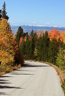
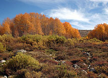
Skyline Drive:
32 miles round trip from Pinedale, 1/2 day trip
Highlights: Paved road, views of 2 lakes, wildlife, view of the Wind River Mountains, picnicking, photography opportunities
This 16-mile one way scenic drive takes you from 7,200 feet elevation in Pinedale to a viewpoint at 9,100 feet with a spectacular view of the Wind River Range mountains. The road begins from Highway 191 in Pinedale in front of Faler's General store and climbs the hill past the Museum of the Mountain Man. It continues up a glacial moraine to a viewpoint overlooking 11-mile long Fremont Lake and entering the Bridger-Teton National Forest. The road continues to climb and wind through open sagebrush hills into timbered forest and aspen groves. The end point is Elkhart Park and Trails End Campground which is a major trailhead into the Bridger Wilderness Area. The entire road is paved, although portions are steep and winding. Pronghorn and deer are often seen along this drive, especially in the early morning and evening hours. The road is generally free of snow from late June until late September. Along the way, there are several scenic pullouts with views of Half Moon and Fremont Lakes. RVs and trucks pulling horse trailers can make this road, just be aware it is narrow in places and has a couple of sharp hairpin turns near the top. There is good turn around and parking space at the top. A Visitor Hut is located at the end of the road manned by volunteers who can answer visitor's questions.
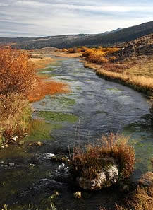
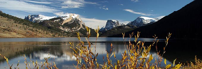
Green River Lakes Road
106 miles round trip from Pinedale, full-day trip
Highlights: Part paved-part gravel road, views of the Wind River Mountains and Sawtooths of the Gros Ventre Range, picnicking, photography opportunities, wildlife viewing, fishing, Kendall Warm Springs
Plan this for a day trip and start in the morning, as it is 53 miles one way to take this drive, but it is well worth the trip. This excursion will take you through sagebrush prairie paralleling the Wind River Mountain Range for many miles. Further on the road winds into the upper portion of the Green River valley with views of the "Sawtooth" mountains of the Gros Ventre Wilderness area to the west. At the boundary with the Bridger-Teton National Forest the road turns to gravel and is slower going the rest of the way, which is a good opportunity to watch for pronghorn, deer, moose and elk along the way. On occasion, a grizzly bear may be seen, but it is rare. This is all grizzly bear habitat though, so special restrictions do apply for food handling for campers. Along the upper portion of this road, fishermen will find many access points to the Green River to drop in a line. You'll pass by Kendall Warm Springs, the home of the protected Kendall Dace, a tiny fish that is found only in this stream. This site is purposely not well marked, so watch for the unimproved parking area and steaming water in the stream just after you cross the bridge several miles past the forest boundary. As you proceed, the scenery just gets better and the most dramatic is when Square Top Mountain comes into view past the big bend in the road. A few miles further the road ends at Green River Lakes and campground, a great spot for a family picnic and short hikes. Start in Pinedale and travel west on Hwy. 191 to the Cora Y and turn north on Hwy. 352. Stay on this road until you reach the very end. The first 29 miles of the trip is on paved highway, the remaining 23 miles is on good gravel road.
Union Pass Road
120 miles round trip from Pinedale, full day drive
Highlights: Part paved-part gravel road, mountain and forest views, wildlife, view of the Wind River Mountains, picnicking, photography opportunities
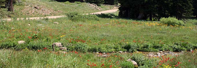
Due to the rough nature of certain portions of this road, a high clearance vehicle is recommended. A sedan can make it if the road is dry and you take it slow and carefully dodge the rough spots. This road has many of the same features described above for the Green River Lakes trip, but turns just before reaching Kendall Warm Springs. If you take the full loop, you will end up in Dubois on the other side of the Continental Divide. Start early in the to make the most of this trip because portions are slow going, which is what makes it so enjoyable. The drive takes you from the floor of the upper Green River valley to the top of Union Pass. The road continues on to Dubois, but you can turn around and come back the way you came to return to Pinedale. You'll pass through scenic sagebrush valleys, conifer forests, aspen groves, and mountain lakes. Wildlife: deer, pronghorn, moose, elk are often seen. Grizzly bear also roam this country, but you'll be lucky indeed to capture a glimpse of one. The road passes by Mosquito Lake about midway up, Fish Creek, and pretty Lake of the Woods near the top. Believe it or not, there is a rest room about 3/4 of the way near the top on this road, a courtesy for those snowmobiling along the Continental Divide Snowmobile Trail. At the summit, the Union Pass Historical marker makes a nice stopping point and a short hike through a lupine meadow takes you to a ring of markers describing the colorful history of this pass. Not far from that point, at the top of the Continental Divide, is a place where a raindrop of water might begin a journey traveling to one of three water drainages: the Missouri, the Columbia, or the Colorado, depending on which side of the mountain the drop of water might land. Besides the beautiful scenery and wildlife viewing along this drive, you're likely to see abundant spring wildflowers blooming somewhere along this road depending on the elevation and month. This drive is typically open from July through September.
McDougal Gap Road
70 miles round trip from Daniel, full day trip
Highlights: Gravel road, mountain and forest views, wildlife, picnicking, photography opportunities
The McDougal Gap Road is the only cross road from the eastern side of the Wyoming Range to the west, and connects between the Green and Greys River valleys. The scenery is spectacular and you won't pass a lot of traffic along the way. The road passes through open sagebrush hills inhabited by pronghorn and sage grouse and into the forested mountains of the Bridger-Teton National Forest. The Wyoming Range is not as rugged or rocky as the Wind River Mountains, but they are certainly spectacular in their own right, and this road offers very stunning views with high mountains and waterfalls. The McDougal Gap road meets US 189 south of Daniel and intersects the scenic Greys River Road one mile north of Forest Park, a distance of 35 miles on gravel road. The Greys River Road has developed camping and many dispersed camping, picnicking, and fishing opportunities. The road is typically open early July through September.
Middle Piney Road
52 miles round trip, 1/2 to full day drive
Highlights: Gravel road, high mountain stream and lake, wildlife, picnicking, photography opportunities
This scenic drive in the Wyoming Range passes two campgrounds and ends at Middle Piney Lake, a favorite for camping, boating and fishing. This lake is also the starting view of a major trailhead into the Wyoming Range mountains. The last portion of the road is steep, narrow and rough and is not recommended for RVs or long trailers. The road begins at WY 350 in Big Piney and is paved for 11 miles. It is another 9 miles to the Bridger-Teton National Forest boundary, and then 6 more miles to Middle Piney Lake, a total distance of 26 miles one way. The last portion of the road is usually not free of snow until early July.
Greys River Road
Full day trip
Highlights: Gravel road, views of Greys River, wildlife, picnicking, photography opportunities
Although technically not in Sublette County, the locals still claim the Greys River and valley as part of their playground. This drive allows you to follow the river for 58 miles and provides an excellent opportunity to watch a small stream become a river. From the Daniel side of the trip, you'll actually be watching the river shrink as you climb to the headwaters of the river and drop over into the Tri-Basin Divide and come out at Big Piney or LaBarge. Bring a forest map along for this drive, as there are several variations possible. If you access this drive from the description above for the McDougal Gap Road to the Greys River Road, continue south at the Greys River junction to make the loop drive. The last 10 miles of this road are rather rough, so a higher clearance vehicle is recommended to clear the last portion at the headwaters. For those in sedans, turn around and come back the way you came back through McDougal Gap. This road offers beautiful scenic views, wildflowers galore (Indian Paintbrush and Lupine especially), seclusion, many great spots for picnicking or fishing, and lots of wildlife viewing. You won't find any services out here, so bring all you need for your snacks, drinks, and fishing gear for the day.
For More Area Information
Sublette County Visitor Center
P.O. Box 176
Pinedale, WY 82941
307-367-2242
Bridger-Teton National Forest
Pinedale Ranger District
29 E Fremont Lake Road, PO Box 220, Pinedale, WY, 82941
307-367-4326/739-5700
Fax: 307-367-5750
Big Piney Ranger District
PO Box 218, Big Piney, WY, 83113
307-276-3375 or 276-5800/5200
Fax: 307-739-5235/276-5835