Mount McDougal
Page Summary: Mount McDougal is located in the mid-northern region of the Wyoming Range in Sublette County, Wyoming.
 Mount McDougal
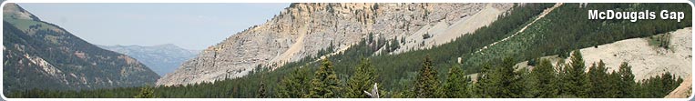
Mount McDougal is located in the mid-northern region of the Wyoming Range in Sublette County, Wyoming. It constitutes the northern border of McDougal Gap and Triple Peak makes up the southern border. These two mountains are the most prominent on the skyline looking due west from Pinedale. Mount McDougal is easily confused as Triple peak to the south, it is important to remember that McDougal is the northern most prominent peak.
Area Activities
Since there is no designated wilderness area in the Wyoming Range, the snowmobiling community arrives in full force in the winter. To snowmobile in this area one must park as at the forest boundary. From here one can snowmobile in several miles before reaching the higher mountains. Traveling alone or without knowledge of the terrain is strongly discouraged especially in the winter months.
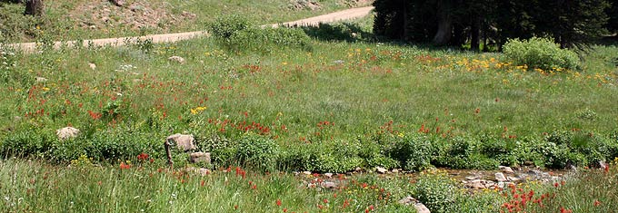
There are some excellent fishing opportunities in this area. The Piney and Cottonwood creeks have strong cutthroat populations. However, cutthroat populations have suffered in the past few years due to area land owners stalking sections of streams with hatchery fish. Hatchery fish are rainbow trout which have the same mating season as the cutthroat. This results in crossbreeding which produces a “Cut-Bow.” Cut-bows are still fun to catch and have no real threat to the environment. Be sure to carry a map while fishing to prevent trespassing on your excursion.
Climbing Mount McDougal
From the Wyoming Range National Recreation Trail parking area, walk about a mile north on an old road and begin the ascent up a steep grassy slope to the summit. The climb is fairly simply and does not require any climbing gear or knowledge of technical rock climbing.
On a clear day one will have views of the Tetons, Gros Ventres, Absorakas, Wind Rivers, Salt Rivers and sometimes the Uinta Mountain Ranges from the summit.
Skiing Mount McDougal
This area of the Wyoming Rang offers excellent back country skiing. In the later spring one can drive to the base and access these slopes as described above. In the winter months one must have a snowmobile to easily access the slopes. If you do decide to search out some turns in this area be sure to have the necessary avalanche gear, a partner, and be updated on current avalanche conditions in the area.
Whatever it is that brings you to the Wyoming Range you will surely be amazed by the natural beauty and tranquility. The Wyoming Range sees much less traffic then the neighboring Wind River Mountain Range making it easy to get away from the crowds. As always, be respectful to the land and pack out what you pack in.
Directions to Mount McDougal
Leave Pinedale heading Northwest on highway 191 to the Daniel Junction. From Daniel Junction turn South on highway 189 and travel approximately one mile. Turn right on the first and only paved road. This is known as the Rye Grass road. The pavement will end after a few miles and the road forks. The right fork is the Rye Grass Road and a high clearance vehicle is recommended for this route. However, to reach McDougal Gap take the left fork, which is well maintained. Travel on this road for several miles and follow signs leading to McDougal Gap. McDougal peak should be visible for the majority of the drive. Just before you enter the “gap” there will be a parking area on your right. This is the Wyoming Range National Recreation Trail parking area.