Skiing & Snowboarding in Pinedale, WY
Page Summary: Skiing, Snowboarding, & Cross Country Skiing guide to Pinedale, WY. Wind River, Gros Ventre, & Wyoming Ranges ski info.
 Skiing & Snowboarding – White Pine Resort
Winter enthusiast will enjoy skiing, snowboarding, mushing, skijoring, and cross-country ski trails just 10 miles from Pinedale. Better yet, how about a ski area that doesn't cost an arm and a leg and where you can literally park your car and get on the lift without waiting in line? That's what makes White Pine Ski Resort such an easy, uncrowded family friendly ski destination. The summit of White Pine's Fortification Mountain rises to an elevation of 9,500 feet and showcases spectacular views of the Continental Divide of the Wind River Mountains, the Bridger Teton National Forest, Fremont Lake, as well as the nearby Wyoming Mountain Range.
NEWS: White Pine Resort will OPEN for 2012-2013 Winter!
The White Pine Ski Resort will be OPEN for the 2012-2013 winter season including lift operations, cross country trails, special events, retail, and dining. Wax those skis, buff those boots and hang on for another wild season at the Pine!
White Pine Resort Hours & Tickets:
- Open Thursday through Sunday: 9am – 4pm
- Half Day-AM Tickets: 9am – 12pm
- Half Day-PM Tickets: 1pm – 4pm
White Pine Resort Links:
- WhitePineSki.com – Official Resort Website
- Check Rates for Lift Tickets and Rentals
- White Pine Mountain Trail Map
- Directions to White Pine Resort
- White Pine Resort Facebook Page
Cross-Country Skiing

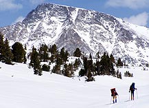
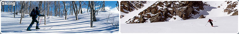
Pinedale offers both groomed trails and off track skiing in the Wind River, Gros Ventre and Wyoming Mountain ranges. The skiing season typically runs from December through mid-April. The vast open spaces offer solitude, diverse terrain and the freedom to go as far as you want. The area along Skyline Drive east of Pinedale offers over 60 km of marked groomed trails designed to accommodate all levels of ability. Skiing in the Wind River, Gros Ventre and the Wyoming Mountain ranges is on logging roads and off track, and is generally for intermediate and advanced skiers. There are over two million acres of public land in Sublette County, providing vistas of incredible beauty to the Nordic skier. Detailed trail maps are available from the Pinedale Ranger District of the Bridger-Teton National Forest, 307-367-4326.
Skyline Drive (Fremont Lake Road) offers over 60 km of marked trails designed to accommodate all levels of ability. Most of the trails are not regularly groomed, so be prepared to break trail, particularly after heavy snowfalls. The Skyline road is plowed and maintained to the turnout just past White Pine area during the winter. Trail maps are available from the Forest Service and Sublette County Visitor Center. Trails are marked with blue diamonds as a guide. Diamonds are not used along road sides or on the Pole Creek Trail (Trail I). Blue snow poles are used in some places. However, snow poles may get knocked over and, because of weather and wear and tear, trail markers may fall off trees. Be prepared to backtrack if you lose the trail. Trail junctions are signed showing destinations. However, as with the trail markers, damage may occur to the signs during the winter. Trail registers are located at the trailheads, and skiers are asked to please register. A note about safety: Many ski trails are at elevations of greater than 8,000 feet in elevation. Also, winter storms can occur rapidly in this area. Please come prepared!
Ski Tips

- Leave an Itinerary with friends showing your route and expected return time. Remember to let friends know that you're back safely.
- Do not underestimate the time needed. Deep and drifting snow can slow you to fractions of a mile per hour. Check your watch and map frequently to check distance covered and distance remaining. Turning back before reaching your objective may be disappointing, but it may save your life.
- Take a map and compass and become familiar with the terrain. Check your map for the proper route.
- Set the pace to suit the least experienced or slowest member of your party.
Equipment Check List:
- Map and compass
- Avalanche Beacon
- Shovel
- Flashlight
- Matches, fire starter, knife
- Extra food and water
- Ski repair kit
- Extra clothing (no cotton)
- First Aid Kit
- Sun glasses and sun screen
- Watch
Weather:
Storms and bad weather are frequent threats while skiing in the Wind River Mountains. High elevations and mountainous terrain make sudden changes and adverse weather common. Check weather forecasts to avoid being caught in a heavy and sometimes sudden storm. Dress for comfort in a variety of conditions. Several layers of clothing will allow you to add or subtract articles as weather and body heat change. Be aware of the signs of, and precautions to prevent and care for, both hypothermia and frostbite.
Hypothermia:
Hypothermia is the rapid, progressive mental and physical collapse that accompanies the cooling of the inner core of the human body. It is caused by exposure to cold and is aggravated by wind, exhaustion, and prolonged exposure to moisture. It is the primary killer of outdoor enthusiasts.
To help prevent hypothermia, dress properly and stay dry. A warm cap is essential. Be well rested and properly nourished. Leave all alcohol at home. Alcohol dilates blood vessels which then accelerates the body's heat loss.
Avalanches
There is little danger of avalanche on many of the identified routes. Some of these trails, however, lead into the backcountry where avalanche potential increases. It is important to realize that a slope does not have to be steep for an avalanche to occur. Many avalanches happen on slopes of less than 30 degrees. The best protection against getting involved in an avalanche is to avoid areas with avalanche potential. Check with the Pinedale Ranger District for general avalanche conditions and learn the procedures on how to locate an avalanche victim.
Trail Courtesy
When the trail is unbroken, a snowmobile track is a welcome track to many skiers. However, once a ski track is established, a snowmobile can destroy it. Snowmobilers should travel adjacent to established ski tracks. If you are a snowshoer or snowmobiler, please yield to skiers. You have better control and can help avoid accidents.
- Skiers moving down slope have the right-of-way.
- Stay in control.
- Don't stop in narrow or steep trail sections if it can be avoided.
- Pack it in, pack it out.
- Wyoming Road Reports
For More Information
Pinedale Ranger District
29 E. Fremont Lake Road
P.O. Box 220
Pinedale, WY 82941
(307) 367-4326
Avalanche Center for Northwestern Wyoming: 307-733-2664